Deep Learning for Climate Adaptation: Detecting Drought from Space
The challenge
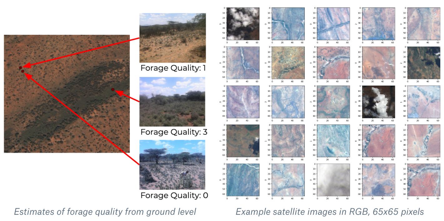
The dataset contains about 100,000 satellite images of Northern Kenya in 10 frequency bands, collected by the International Livestock Research Institute. Local experts (pastoralists, or nomadic herders) manually labeled the forage quality at the corresponding geolocations—specifically, the number of cows from {0, 1, 2, 3+} that the location at the center of the satellite image can feed. Each satellite image is 1.95km across, and each pixel in it represents a 30 meter square. Pastoralists estimate the forage quality within 20 meters when they stand on location, an area slightly larger than a pixel in the full 65×65-pixel satellite image. The satellite images thus provide a lot of extra context, which may prove useful since forage quality is correlated across space. The challenge is to learn a mapping from a satellite image to forage quality so we can more accurately predict drought conditions. Furthermore, the current labeling is very sparse, and we want dense predictions of forage quality at any pixel in a satellite image, not just at the center.
